.jpg)
.jpg)

DALLAS — In an era of satellites, AI, and machine learning, it might seem surprising that many of aviation’s core weather tools still follow standardized formats created decades ago. Yet every pilot and dispatcher around the world begins flight planning with METARs (Meteorological Aerodrome Reports) and TAFs (Terminal Aerodrome Forecasts), and by tuning into real-time weather feeds from AWOS and ASOS (Automated Weather Observing Systems). While these formats date back to the mid-20th century, they’ve been continuously maintained, digitally distributed, and now coexist with modern APIs, satellite data, and advanced forecasting models.
Legacy Observers: METARs, TAFs, AWOS/ASOS and Terminal Radar
Modern aviation relies on a remarkably old-fashioned set of tools. At every airport around the world, routine weather is summarized in METAR bulletins (actual conditions) and TAF bulletins (short-term forecasts). Issued every half‑hour to three hours (depending on country and airport), these terse codes convey cloud ceilings, visibility, winds, precipitation and more. For example, in India the Met Service issues METAR observations “half-hourly”. In the U.S., the National Weather Service’s ASOS network (over 900 sites nationwide) and FAA’s AWOS units (automated systems, mostly at smaller fields) automatically sample conditions around the clock. Globally, similar networks exist in Europe, Asia and beyond – often deployed decades ago – forming the foundation of every preflight weather briefing.
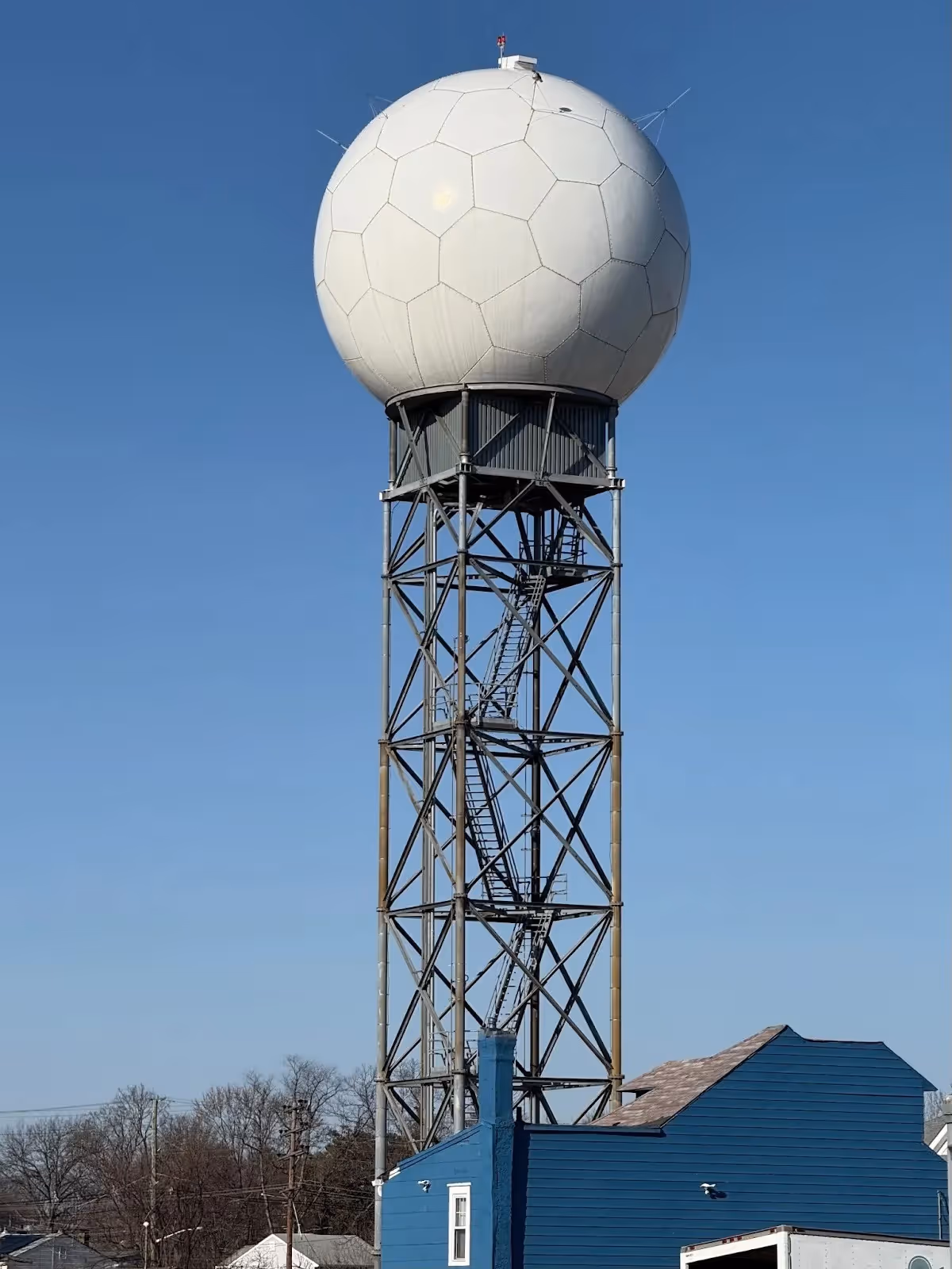
Air traffic control and airlines also depend on local radar and sensor systems. In the U.S., the FAA’s Terminal Doppler Weather Radars (TDWR), deployed at ~45 major airports, scan for dangerous windshear, microbursts and heavy storms. Europe and Asia have analogous ground‐based radars (often older modified civil‑meteorological radars) that feed controllers and pilots. At smaller fields worldwide, individual AWOS or ASOS towers report weather at fixed intervals (AWOS usually every 20 minutes, ASOS every minute). These systems even archive data for climatology and modeling – but their primary job is real-time safety.
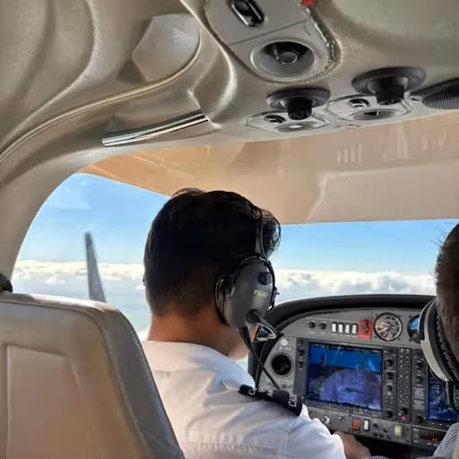
How crews use them: Before every flight, pilots receive the latest METARs and TAFs for departure, destination and alternates. Dispatchers do the same, overlaying these bulletins on en-route charts. On approach, flight crews rely on ATIS broadcasts built from AWOS/ASOS readings (“ATIS: visibility 5 miles, rain, temp 18°C, QNH 1013, runway 27”) to make landing decisions. Tower controllers depend on TDWR to warn of sudden wind shifts on final approach. In short, this 20th‑century gear is everywhere: even long‐range over-ocean forecasts (WAFS charts) ultimately derive from the same observations.
Thus, despite modern computer forecasts and satellite images, very real lives hinge on these basic reports. They are interoperable across countries (ICAO regulations mandate global METAR/TAF standards) and are understood by every trained aviator.
Cracks in the Foundation: Limitations and Incidents
But these legacy observers have clear blind spots. They paint only an averaged picture of what’s happening right where the sensor sits, and only at discrete times. If weather is changing rapidly or highly localized, METARs and automated sensors can be misleading. Multiple studies have found that automated systems like ASOS/AWOS often under- or over-estimate low ceilings and visibility in marginal IFR conditions. In practice, that can ruin an approach. For instance, one general-aviation pilot, recounts approaching Boston Logan with an ATIS reporting “300 scattered, 3800 broken”, only to break out of clouds well below those ceilings. He went missed on multiple approaches while the airport continued to broadcast the outdated automated observation.
AWOS/ASOS failures also pose a stark danger. In May 2025, a small jet crashed attempting to land at San Diego’s Montgomery Field. Investigators found that the ASOS at the airport was malfunctioning, and no NOTAM (Notice to Airmen) was issued warning pilots. Thomas Anthony of USC’s Aviation Safety Program summed up the shock: “The weather observation is a piece of critical information that a pilot needs to have in making his decision to land” – and yet pilots were unknowingly flying without it. Even routine discrepancies can accumulate risk: hidden icing, unexpected winds, or a microburst can emerge in the gap between two 30-minute ASOS reports.
Terminal Doppler radars, too, are not infallible. Though TDWR has helped prevent major accidents (the FAA notes “no wind shear accidents [at TDWR-covered airports] since 1994”), those units themselves are old tech running on legacy parts. They cover only a few dozen U.S. airports, leaving other hubs dependent on less‐sophisticated wind-shear alerts from tower anemometers or ground reports. Outside high-density zones, pilots and controllers often have to rely on pilot reports (PIREPs) or visual observation – an imperfect stopgap.
“It’s still a lot of gray,” says one veteran airliner dispatcher. “You look at a METAR and hope it hasn’t gone out of date while you climb.” (Cited sources echo this uncertainty; e.g. poor sensors left Alaska pilots blind to deteriorating weather.) In mid-2025, there were calls for exactly this: following the Bering Air crash near Nome (Feb 2025), NTSB investigators and lawmakers emphasized that “pilots deciding whether it’s safe to fly rely heavily on information from the state’s network of AWOS”. Disturbingly, Alaska Senator Lisa Murkowski found 51 of 150 AWOS towers down in her state on one recent morning. Murkowski lamented that stranded pilots are forced “the old-fashioned way, …checking with people on the ground” for weather. In sum, outdated weather tech can leave crews making critical decisions in a fog of uncertainty.
A Global Snapshot: U.S., Europe, Asia
Worldwide, the picture is remarkably similar. In the United States, the FAA and NOAA literally built much of the global aviation weather infrastructure. It's ~900 ASOS, and 800+ AWOS (Automatic Weather Observing) stations span the country, and controllers use ATC radars and TDWR as described. Yet, as recent audits show, many systems are decades old and hard to replace. A 2024 FAA Inspector General report found only 16% of promised NextGen modernization benefits delivered even after US$15 billion in funding – modernization of weather systems included. The FAA’s 2024 budget request acknowledges a US$8 billion effort to modernize 377 aging radar facilities (average age: 36 years) across the NAS. The message: even radar (vital to weather surveillance) is overdue for replacement, but funding and bureaucracy slow the process.
In Europe, each country maintains its weather infrastructure, but efforts to modernize are underway. European pilots’ associations and agencies have long stressed harmonization (ICAO and IFALPA emphasize “a single air navigation system” globally). European Air Traffic Management modernization plans (SESAR and the EU ATM Master Plan) include improvements to weather data.
Automated airport weather networks (ASOS or national equivalents) are widespread in EU countries – for instance, Germany’s DWD and the UK Met Office together maintain 100+ stations for aviation. Even Japan and India, rapidly expanding their flight networks, still run METARs at major airports and AWOS stations. India’s Meteorological Department proudly notes its “Surface Observational Network is continuously upgraded with modern instruments” – yet it still produces METARs and TAFs as core products. In short, from London to Shanghai, pilots still receive weather data in the same format, from the same sensors, as their predecessors did 50 years ago.
Why Old Tech Endures
With all these cutting-edge options, why do carriers remain anchored to the old ways? The answer lies in safety, cost, and regulation. Legacy systems are proven. A METAR-coded TAF is officially endorsed by ICAO (Annex 3), so crews implicitly trust it. Replacing that across 50,000+ worldwide aerodromes and training every pilot would be a monumental effort. Similarly, AWOS/ASOS systems feed directly into global data networks and ATC systems; removing them would create dangerous blind spots. The FAA explicitly notes that “radars remain a critical and necessary part of the NAS” because many aircraft lack the onboard ADS-B equipment that could someday provide weather info. In other words, today’s jets rely on infrastructure that was often built before the jet age – but those systems still work.
Cost and bureaucracy are significant hurdles. In the U.S., upgrading or replacing weather stations and ATC radars requires federal funding rounds, environmental reviews, and congressional approval. The FAA’s plan to refresh radar systems will cost billions and span decades; similar budgets would be required for sensors. Many airports worldwide (especially in developing regions) lack the tax base to self-fund modern networks, and national budget processes are slow-moving. And because safety regulations are rightly strict, any new technology (even if promising) must be rigorously certified. For example, AI-generated weather bulletins or forecasts must be vetted by human meteorologists and shown to meet ICAO standards before pilots can depend on them. This institutional inertia means airlines often adopt new tools in parallel, rather than changing the official workflow.
Finally, redundancy matters. Aviation is safety-obsessed, so having multiple independent sources is a virtue, not a weakness. While AI and satellites offer new angles, they’re generally used in addition to – not instead of – traditional data. Even the top minds behind AI forecasts stress this: ECMWF’s leaders emphasize that their new AI-based model (AIFS) is deployed “alongside” the conventional model, complementing it. The U.S. FAA echoed this philosophy: despite pushing a multi-year radar overhaul, the agency notes that “the safety and security of our airspace depends on resiliency”, meaning radars plus GPS and other systems.
In practical terms, when a dispatcher sees a weather warning from an AI app, they will still check the METAR, ask air traffic control for runway reports, and possibly call the tower – just like in the days of landlines.
Modern Tools Joining the Fray
Although legacy systems remain the primary ones, airlines and meteorologists aren’t standing still. A quiet revolution is underway in the background. On the forecasting side, AI and machine learning are making enormous strides. In early 2025, the European Centre for Medium-Range Weather Forecasts (ECMWF) introduced its AI Forecasting System (AIFS) into operations. The AIFS, trained on past satellite and radar data, already outperforms traditional models in many scenarios (for example, tropical cyclone tracks with up to 20% better accuracy) while using a tiny fraction of the computing power. ECMWF’s Director-General Florence Rabier says this will “transform weather science and predictions”.
Airlines and tech companies are already leveraging AI and new data sources to enhance the outdated baseline. For instance, Airbus, in partnership with EUMETSAT, is launching next‑generation weather satellites (MetOp-SG) equipped with cutting-edge sensors for infrared, microwave, and polarimetric imaging. These satellites will feed ultra-precise atmospheric data into global prediction engines for decades to come, effectively doubling the fidelity of the next weather model's output.
In the cockpit and operations center, crowdsourcing and “Internet of Things” data are creeping in. Some major carriers now use turbulence-detection apps (e.g., SkyPath or in-house equivalents) that aggregate hundreds of real-time pilot reports and aircraft sensor readings to map areas of turbulence. Emirates, for example, recently deployed an AI-based turbulence prediction system that fuses machine learning with pilot-reported turbulence and wind data. By giving pilots “live, in-situ turbulence visualizations,” they report fewer surprises at altitude.
Even general-purpose AI is being tested. Large Language Models (LLMs) and image analysis tools can now digest raw weather data and radar loops to assist human meteorologists. Experiments show AI can rapidly “triage” weather charts and highlight dangerous features to dispatchers. But experts caution these are still tools, not replacements. The WMO notes that integrating AI into operations “will require investment in people, principles and partnerships to ensure trust, transparency and equity” – basically, flight crews still get the final say.
In short, the sky is getting smarter – but mostly in parallel channels. Airlines might feed AI forecasts into their dispatch software, and passengers can check augmented weather apps on their phones. On board, crews might see satellite radar overlays or receive AI-generated estimated TAFs. But critically, none of these has yet displaced the official METAR/TAF/AWOS chain for regulatory flight decisions. Instead, modern tools are increasingly acting as value-added layers: improving awareness, filling gaps, and making decision-makers more proactive.
For now, a dispatcher relies on the METAR from the control tower and also glances at a high-resolution convective forecast from an AI model, rather than replacing one with the other.
Bureaucracy and Budgets: Why Change Crawls
Underlying all this is a web of institutional and financial inertia. Aviation is heavily regulated, and every sensor upgrade or procedural change requires coordination among airlines, airports, meteorological agencies, and regulators (FAA, ICAO, EASA, etc.). Unlike consumer tech, there is no venture capital engine driving the replacement of METARs – it’s a government and industry undertaking. For example, adding a new weather satellite to the mix involves collaboration between space agencies, national weather services, and international consortia (as seen with NOAA’s GOES or Europe’s MetOp programs). The payoff is long-term (better forecasts), so funding rounds can be infrequent and slow.
In the U.S., lawmakers have only recently begun to pour money into weather infrastructure. The 2021 FAA reauthorization authorized millions for Alaska’s weather stations (after years of vocal advocacy) – but many stateside projects remain unfunded. Even the FAA’s latest budget request (for FY2025) is a fraction of what’s needed; the agency noted billions are required just to maintain existing facilities. In Europe, the cost of replacing ATC weather radars and obs is similarly high, and many priorities compete (e.g., environmental initiatives, digital ATC). Asia-Pacific nations often wait for larger regional bodies (like ICAO Asia/Pacific offices) to coordinate upgrades, making unilateral steps rare.
Cultural factors also play a role. Pilots and controllers are trained to trust certain symbols and reports. Changing formats (say, moving to purely graphical or raw-data bulletins) would require retraining and re-certification. There is also a philosophical caution: no one wants to “throw out the baby with the bathwater.” Regulators insist on thorough validation. For instance, although ECMWF's AI models are impressive, meteorologists emphasize that ensembles and probabilistic forecasts remain necessary to assess uncertainty fully.
Finally, in many cases, old tech still works well enough. Automated weather stations routinely produce “minute-by-minute” METAR observations. Run-of-the-mill flights rarely encounter truly catastrophic surprises if crews combine METARs, radar, and PIREPs. Insurance and safety investigations tend to focus on human or maintenance errors before blaming a mistyped METAR. So, without a crisis-level of risk, political will to fund wholesale replacement has been slow to materialize – even if industry insiders constantly urge it.
Looking Ahead: The Next 5–10 Years
So what’s on the horizon? Realistically, we should expect incremental evolution rather than a sudden overhaul. Over the next decade, satellites and AI will continue to roll out. High-resolution imagers (such as the Airbus-built MetOp-SG satellites) will feed global data into models, enriching forecasts. AI-driven models are poised to take over standard medium-range forecasts (ECMWF’s traditional physics model already runs side-by-side with its ML model), and weather advisors in cockpits may start digesting multiple sources for the crew. Airlines will extend predictive apps (fuel, turbulence, tailwinds) that dynamically ingest all available data.
We will also likely see modernization of delivery, even if the underlying formats persist. ICAO and WMO have been moving METAR/TAF to digital (XML-based IWXXM formats) behind the scenes. Future automated systems might generate an AI-TAF and log it in the official format, satisfying both innovation and compliance. Flight planning systems might automatically cross-check the “old” forecasts against crowd-sourced sensor networks (from smartphones, drones or other aircraft), flagging discrepancies.
However, legacy systems won’t vanish fast. Even by 2035, expect METARs/TAFs to be on every flight plan, and AWOS/ASOS towers still reporting every few minutes. As the FAA’s radar plan notes, radar isn’t going away “for the next 20+ years”. What will change is additional behind-the-scenes support: improved algorithms to correct or supplement the old data, and a gradual rollout of new sensors as budgets allow. In remote regions (such as Alaska or parts of Asia), satellite-based observations (e.g., GNSS radio occultation for moisture or geostationary lightning mappers) might partially fill gaps left by local towers. And regulatory momentum around climate change and big data may eventually push more funding to weather tech.
Key Takeaways
- Everyday Tools: Pilots worldwide still plan flights on METAR/TAF and AWOS/ASOS data – simple coded reports that date back to the mid-20th century, but remain standardized and universally accepted. Terminal Doppler radars (chiefly in the U.S.) detect wind shear, but rely on 1990s-era hardware.
- Known Gaps: These systems have limitations. Automated observers (ASOS/AWOS) can miss sudden weather changes; one recent accident occurred when an out-of-service ASOS failed to issue a warning. Studies show automated stations often underestimate or overestimate visibility and ceilings under marginal conditions. Alaska’s pilots still grapple with dozens of broken AWOS units, forcing them to call ground stations for updates.
- Safety vs. Innovation: Aviation’s “safety-first” culture demands absolute confidence in weather data. Changing the fundamental format (e.g. ditching METAR/TAF) would require an overhaul of global rules and retraining. Until new methods are proven out in every scenario, regulators insist on building them around the old system.
- Realistic Outlook: In the next 5–10 years, we’ll see a layered approach. Traditional METAR/TAF-based briefings will be supplemented by richer graphics, AI “forecast assistants”, and real-time sensor networks. Radars and AWOS units will be incrementally replaced or upgraded (for example, the FAA’s radar program plans to replace many units by the 2030s). However, the pilots and dispatchers in 2030 will still reference METARs in their preflight reports – possibly generated or validated by AI, but presented in the same trusted format. The slow pace is a feature of safety-critical systems, not a sign of neglect.
In cockpits and control rooms worldwide, 2025 is a mix of old and new. Airline crews now work with powerful modern tools, but still rely on the same trusted weather reports that have guided flights for decades. The weather is becoming easier to predict in some ways, and harder in others. One foot is in the digital age, but the other still stands firmly in the analog systems of the past.
Until the skies are fully modernized, pilots will continue to navigate the future using tools from the past, proving that in aviation, trust and tradition still fly side by side with innovation.
Stay tuned to Airways and follow us on LinkedIn and Instagram for the latest updates. Featured image source here.
Featured image: Puneet Singh Rawat/Pexels

.avif)
_in_Pennsauken_Township,_Camden_County,_New_Jersey.jpg)